CSA Offers Autonomous Surface Vessels (ASVs) for Rapid Response Survey, Channel Clearance and Damage Assessment
The true extent of the damage caused by Hurricane Helene remains to be seen, but the rising death toll and accompanying images of catastrophic structural damage to houses and critical infrastructure paints a bleak and very worrying picture. The storm made landfall in Florida’s Big Bend on Thursday, September 19, 2024, bringing 140 mph winds and a 15-foot storm surge to those areas worst impacted.
Recently published drone footage of Keaton Beach makes for sobering viewing, with Taylor County officials estimating that 90% of the homes in this once idyllic Gulf Coast community have been effectively wiped off the map, swept away by a wall of water and violent winds.
The storm then dumped torrential rain on the Carolinas and Tennessee, causing dams and waterways to overflow. Busick, in rural North Carolina, reportedly received over 31 inches of rain in two days.
As the devastation across several states becomes clearer by the hour, CSA Ocean Sciences Inc. (CSA) has readied its fleet of autonomous surface vehicles (ASVs), available with or without an operator, to assist public authorities with the urgent recovery efforts in coastal and waterway communities impacted by the Category 4 storm.
A Proven Application of Cutting-Edge Technology
CSA has extensive experience providing a full range of marine environmental survey services designed to aid urgent and long-term post-hurricane relief.
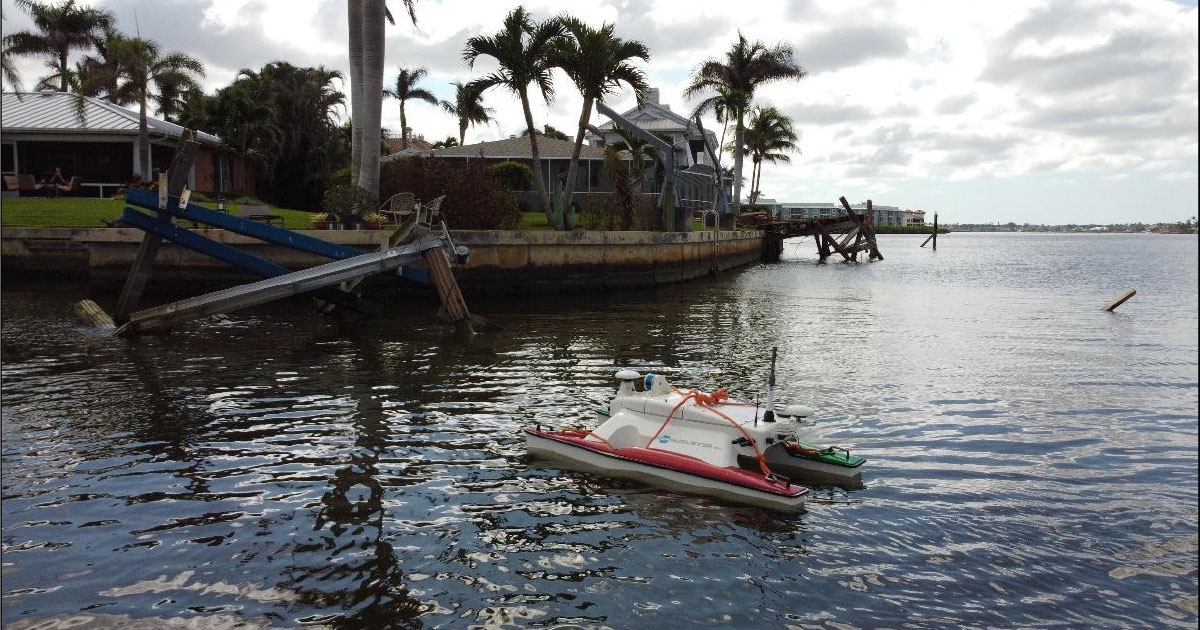
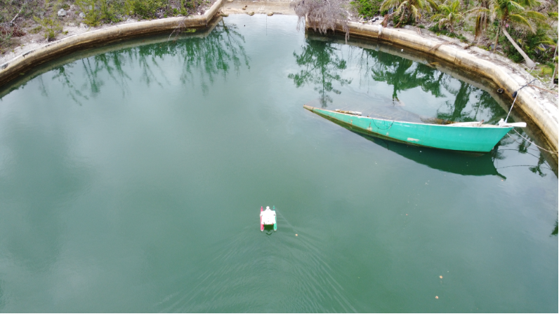
The aftermath of destructive weather events, such as Hurricane Helene, is typically characterized by dangerously impeded waterways, and as waters recede, ASVs provide the safest way to navigate and inspect hazardous and hard-to-reach areas. CSA’s lineup includes several SeaRobotics M1.8 ASVs, a compact and easy-to-deploy unit ideally suited to remotely capture data needed to accurately assess channel clearances, LiDAR-assisted damage, and scattered debris fields.
In recent years, following a pronounced uptick in landfalls of named storms, CSA ASVs and operators have been used to accelerate rescue efforts in both the US and overseas. Hurricane Dorian was an extremely powerful and catastrophic Category 5 Atlantic hurricane that ravaged the Bahamas in September 2019. It is the most intense tropical cyclone on record to strike the island country and holds the ominous record—tied with the 1935 Labor Day hurricane—for the strongest maximum sustained winds to hit land in the Atlantic basin.
Once the storm had passed, CSA immediately mobilized a team of hydrographic survey experts to deploy ASVs to assist in the search and recovery operations in the waterways of Grand Bahama, which included mapping for dangerous debris caused by the extreme winds and 25 m storm surge. The portability and modular versatility of the ASV allowed us to run quick spot surveys of manmade structures found in some of the inlets, as well as hard-bottom mapping and beach profiling.
In September 2022, it was Hurricane Ian’s turn to wreak havoc during the peak of the Atlantic hurricane season, with some of the most significant damage caused to the southwest coast of Florida. Sustained winds peaked at 160 mph (260 km/h) prior to making landfall. As with Hurricane Dorian, the damage was widespread, again with much of the destruction impacting residential areas and the surrounding waterways.
CSA’s ASVs were rapidly mobilized to multiple locations in the Naples region to carry out a series of canal mapping deployments. These deployments helped assess the risk of debris caused by the storm and provided a detailed geospatial view of the waterway to help inform planned dredging operations. Once again, one of CSA’s SR-Surveyor M1.8s, manufactured by SeaRobotics, was chosen for the task.
Optimal Form and Function
There are several distinct advantages to deploying ASVs in time-sensitive post-hurricane relief efforts, especially in restricted and potentially dangerous waters. In the case of the SR-Surveyor M1.8, the ASV’s shallow draft and advanced maneuverability make it the ideal platform for accessing hard-to-navigate spaces, allowing operators to keeping personnel out of harm’s way.
The ASV’s sensor suite is also critical to efficient and precise data collection and includes a Multibeam Echosounder (EdgeTech 2205), as well as a cutting-edge LiDAR (Velodyne)—both critical for infrastructure inspection above and below the waterline. While only 1.8 m in length, the tightly integrated, man-portable ASV delivers synchronized data capture of two frequencies of side scan, motion tolerant side scan, wide swath bathymetry, backscatter, LiDAR point cloud data, and discharge data.
Quality Data When You Need It Most
In the wake of a major hurricane making landfall, time is of the essence, both in terms of assessing damage and assisting immediate recovery efforts. Rapid deployment is key. By deploying ASVs, as opposed to conventional crewed survey boats, operatives are able to use the interferometric side scan sonar and multibeam sonar to quickly process key decision-making data. The option of deploying multiple ASVs at the same time in swarm formation is also a scalable means of accelerating coverage, even when the conditions remain hazardous.
While onsite in some of the worst locations impacted by Hurricane Dorian and Hurricane Ian, we were able to process data in real time from a shore-based command and provide the relevant authorities with the information needed to prioritize relief efforts.
CSA has ASVs for rent and a full range of marine environmental services available for rapid mobilization. Visit https://www.csaocean.com/services/marine-operations/marine-survey-equipment/autonomous-surface-vehicles for more information.
Corporate Headquarters
8502 SW Kansas Ave.
Stuart, FL 34997
Recent Blogs
- CSA Offers Autonomous Surface Vessels (ASVs) for Rapid Response Survey, Channel Clearance and Damage Assessment Oct 2, 2024
- A Team of Leading Scientists from CSA Ocean Sciences Publishes New Paper on the Ecological Effects of the Block Island Wind Farm Sep 11, 2024
- Beacon Offshore Energy Commits to CSA’s Visual Observer Training for Rice’s Whale Protection Aug 12, 2024